

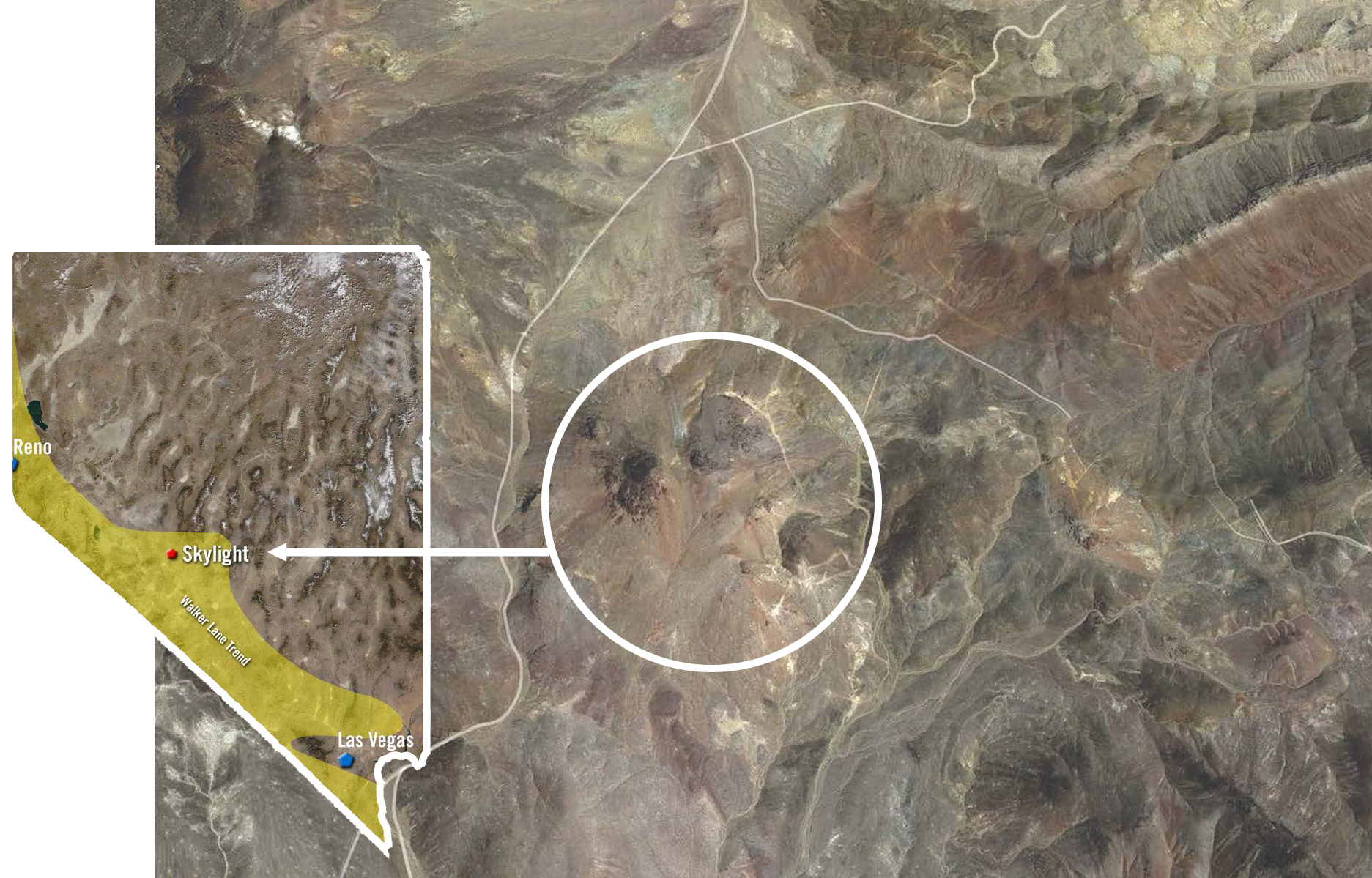
Skylight Property
The Skylight property is located at 38°29’ N, 117°39′ W (Section 12, Township 7N, Range 38E) in Nye County, Nevada. The property is 60 km northwest of Tonopah in the Royston Hills. The property can be accessed by 4WD vehicle from Route 89 (Gabbs Pole Line Road) via a dirt road branching to the south at mile 36 on the Pole Line Road. The property is staked on lands administered by the Bureau of Land Management with no surface rights impairments
Exploration History
The Skylight Property is located in the southern section of the Republic Mining District, a mining camp noted for small high-grade silver epithermal deposits. The first mine in the area was discovered by Lew Cirac in 1905 (Cirac or Orizaba Mine).
This became the dominant producer in the district, yielding $128,000 of high grade silver ore from 1913 to 1918 and undocumented production thereafter until the 1940’s. A small town of perhaps 600 (Republic) briefly flourished near the mine for about a year. In the southern portion of the district, the Cole Spring Mine was discovered in the 1920’s. More a collection of workings surrounding a small mill than a single mine, it appears to have been in operation until the 1980’s. A recent promotional video on the prospect stated it produced gold ore associated with galena. The Skylight property is approximately 2.5 km west of Cole Spring Mine and was explored by Newmont Mining and Rimfire Minerals Corporation as part of a joint venture covering a large portion of the Walker Lane. They identified what they felt was a fully preserved epithermal system at their Poncho property and it was one of the highest priority targets identified during the JV. Rimfire tested Poncho with 6 reverse circulation holes on the accessible flanks of the target in 2007. Unfortunately, this program occurred at the end of the JV and Newmont declined to pursue the target despite encouraging results. Rimfire was unable to secure another partner and returned the property to the vendors. It lapsed and the target was re-staked as the Skylight Property by Silver Range Resources in 2016.
Skyline Project Outline
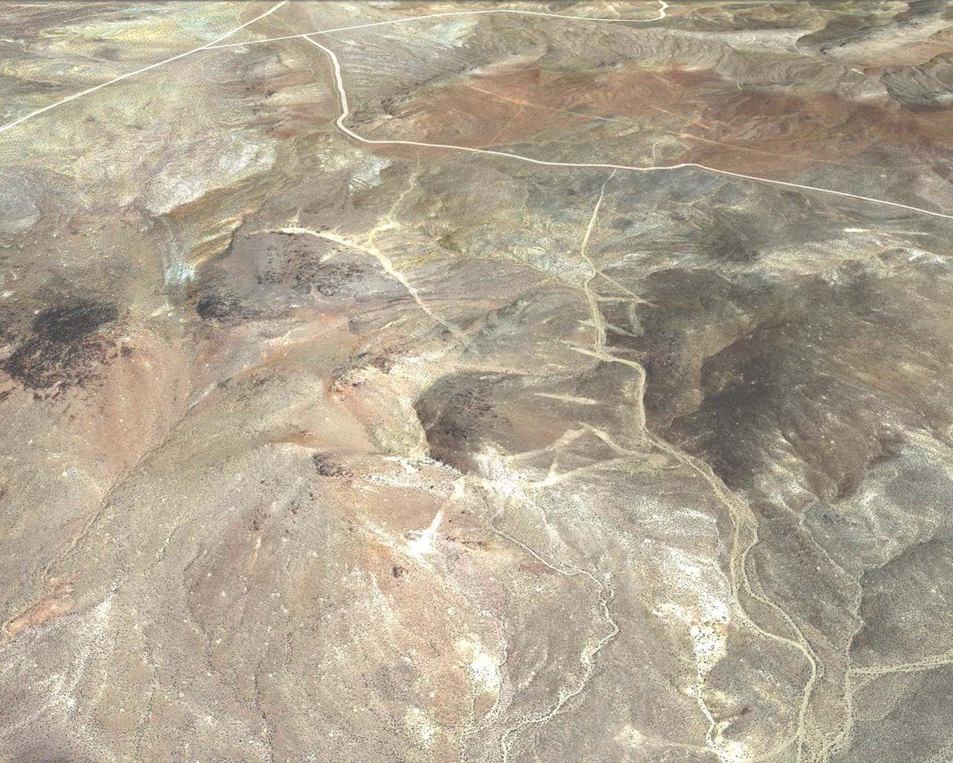
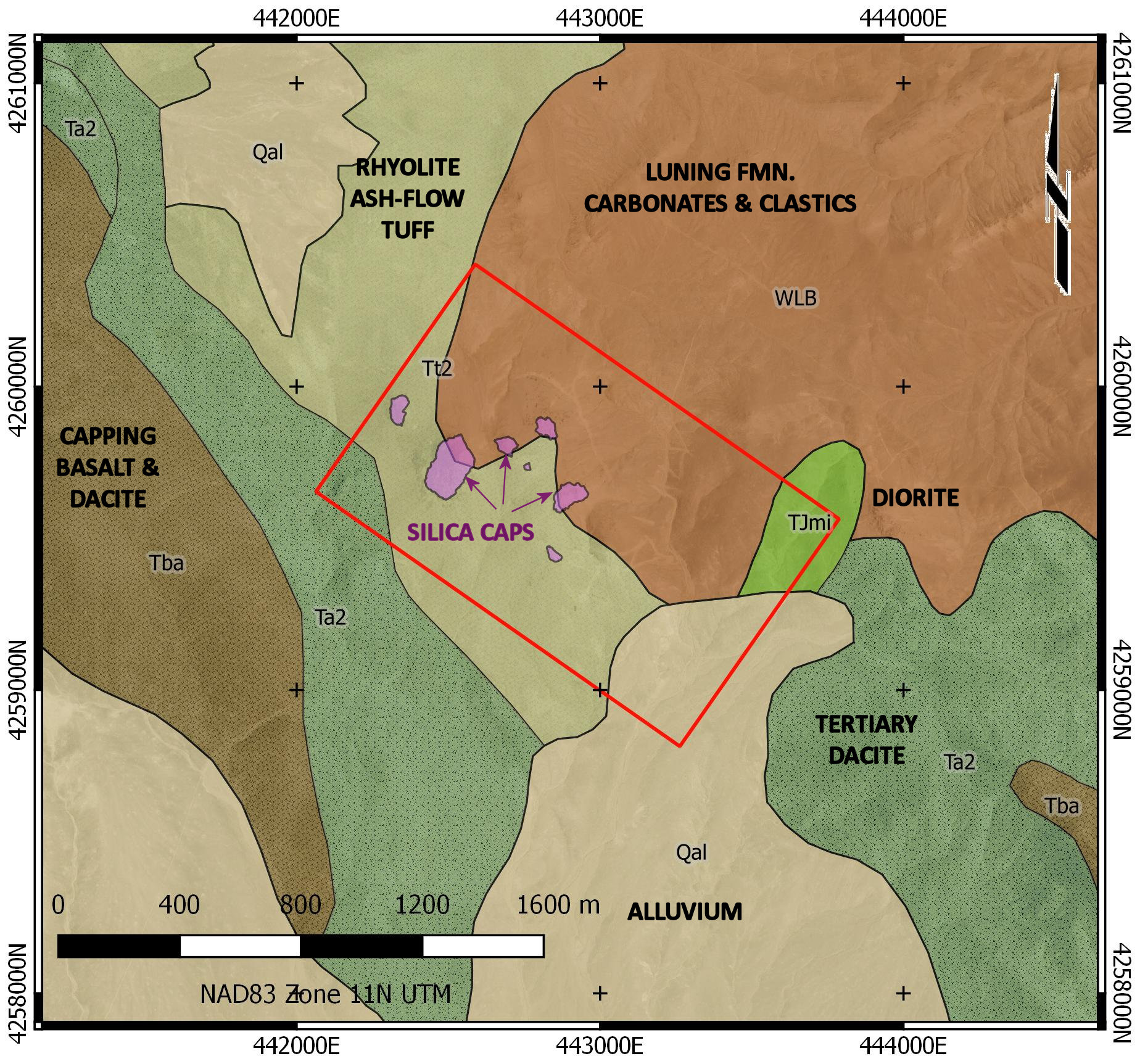
The Skylight Property is underlain by mid-Tertiary ash-flow tuffs unconformably overlying Triassic Luning Formation carbonates and clastics. Structure in the area is dominated by NW trending right lateral strike-slip faults and subordinate N to NNE striking steeply dipping secondary normal faults. The Skylight Property is centred on flat lying silica beds capping the volcanic rocks. These form the tops of the local hills, preserving the underlying rocks from erosion. The silica caps are dominantly brecciated but locally show flat-lying thin-bedded silica indicating they were deposited at the very top of a hydrothermal cell in an epithermal outflow zone.
Quartz veins up to about 1 m wide and clay alterations zones tens of metres wide occur at lower elevations in gullies on the flanks of the silica-capped hills. One vein shows prominent quartz-after-calcite (QUAC) texture indicating epithermal boiling while dickite and hydrothermal kaolinite are found in some of the clay alteration zones. The peripheral veining carries low grade gold values with historic surface sampling returning values up to 2.04 g/t Au. Sampling by Silver Range Resources in 2017 returned best results of 0.86 g/t Au and 67.6 g/t Ag from a suite of 24 grab samples.
Skyline Property Exploration
Rimfire drilled 6 holes (1575 metres) on the flanks of the silica caps at Skylight in 2007. (Rimfire Minerals Corporation News Release – November 6, 2007). Intercepts were reported from three holes: 10.67 m @ 0.49 g/t Au; 3.05 m @ 1.766 g/t Au; and 3.05 m @ 0.608 g/t Au.
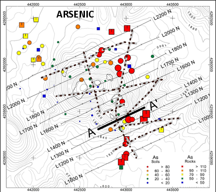
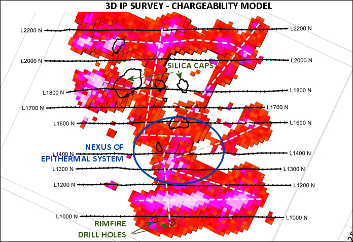
In June 2017, Silver Range conducted a three-dimensional induced polarization (3DIP) survey over a grid centred on the silica caps at Skylight. The survey defined a network of chargeability linears, collectively forming a network with a nexus centred beneath the region of the silica caps. Elevated gold, silver and arsenic values are associated with several of these linear chargeability anomalies. The southern terminus of the most prominent appears to be the target inconclusively tested in Rimfire hole RC07-04. This failed to reach target depth but nonetheless intersected 10.67 m @ 0.490 g/t Au. Surface rock samples collected in this area returned 0.53 g/t Au and 0.86 g/t Au. The chargeability linear follows a gully with an associated clay alteration zone containing dickite and hydrothermal kaolinite.
Results of exploration work to date at Skylight indicate that it is underlain by a nearly completely preserved epithermal system and that the system is gold-bearing. The recent geophysical surveys have defined the system’s structural architecture and identified an area where fluid may have been most intense. Silver Range has designed a drill program to conclusively test this system, targeting the linear chargeability anomalies with best geochemical support.